Land Planning and Recreation
McGill’s award-winning land planning and recreation team is known for designing and creating spaces that seamlessly tie together built and natural environments. Our team maintains a harmonious balance and sustainable design with each project they undertake. We have received special recognition by organizations, including the North Carolina American Society of Landscape Architects and the North Carolina Main Street Center. Through our comprehensive suite of planning, design, and support services, McGill takes the time to understand the unique culture of every community to create exceptional places for future generations.

Urban and Public Space Design
Community is at the heart of our design. We have made it our job to intimately understand the varying values, cultures, and needs of each community we serve; this contextual understanding is leveraged to develop a comprehensive and cohesive vision for the future. Our planning and design methods are based on an iterative process of layering and considering various cultural, systemic, and environmental components to solve complex design issues. By blending these components, we produce holistic designs, weaving the old with the new, to create unforgettable places with function, distinct beauty, and identity.

Land Planning
McGill works with our clients to establish vision, goals, and strategies to achieve desired community outcomes. Creation and regeneration of sustainable and memorable public places requires cultural, environmental, and economic investment. Furthermore, it requires community engagement and support. We utilize an ecologically sensitive planning approach that considers topography, landform, natural resources, vegetation, community input, infrastructure, and buildings. Our team members use this input to create sustainable designs, allowing future generations to live in a healthy and dynamic community, improving their quality of life.

Streetscapes
From mainstreet to a busy city corridor, McGill’s streetscape projects can transform an area into a desirable destination for investment and pedestrian activity. We incorporate economic revitalization, land use, landscape architecture, and development strategies into each project to foster economic vitality, long-term growth, and sustainability. Our designs are informed through a complex set of factors, such as traffic patterns, business landscape, residential usage, transportation routes, utilities, public space improvements, street lighting, ADA compliance, sidewalks and crosswalks, decorative plantings, traffic signals, traffic flow, and parking. The end goal is to support new investment, improved transit access, and enhance pedestrian activity.

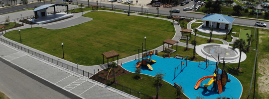
Parks and Recreation
We are passionate about recreational design and creating places for community connectedness. Community parks function as centers of communities, connecting land, rivers, and people in the places where they live and work. McGill strives to create sustainable and function designs for recreation purposes that promote the holistic development and overall well-being of the individual user, as well as the broader community. Collaboratively, we work with our clients to develop a vision for each community that promotes active and healthy lifestyles.

Greenway and Trail Design
McGill has years of greenway, trail feasibility, and design experience throughout the Southeast. We value and understand the impact trails have on communities by creating connections, encouraging physical activity, strengthening local economies, protecting the environment, and preserving cultural and historical areas. Our designs start with a foundational understanding of current assets, usage, linkages, natural resources, and transportation patterns; this basis is then coupled with collaborative community and stakeholder input on short- and long-term goals and objectives. Through this process, we consistently produce unique, purposeful, and implementable holistic solutions.

Bicycle and Pedestrian
Alternative transportation methods are becoming increasingly popular in communities, and citizens are using these methods for recreation and travel for pleasure, as well as for work. Non-motorized transportation benefits both individuals and communities. McGill’s team is comprised of landscape architects, planners, and engineers who seamlessly work together to create successful approaches for comprehensive multi-modal transportation planning – resulting in walking or biking becoming a part of everyday life. We consider safety, including the street and walkway design, community connectiveness, overall health benefits, and economic impact on every project.

Goat Island Park and Greenway, Town of Cramerton, NC

Brookshire Road Soccer Field, Watauga County, NC

Outdoor Classroom, Town of Farragut, TN

Downtown Streetscape, City of Sanford, NC

Founders Park, Town of Kernersville, NC

Ocean Isle Beach Park, Brunwick County, NC

South Caldwell High School Track, Caldwell County, NC

Waterfront Park Master Plan, Town of Calabash, NC
